 ReddRadar
Top AI tools for Urban Planner
-
 LTU Tech Advanced Visual Recognition and Image Analysis Solutions
LTU Tech leverages patented algorithms to deliver advanced image recognition, visual search, and risk management solutions across industries, enhancing operational efficiency and asset protection.
- Other
-
 Snaptrude Program to proposals at lightning speed with data-backed design concepts
Snaptrude is a web-based 3D modeling and space planning tool that enables architects and designers to create and validate design concepts quickly, complete with AI-powered rendering capabilities.
- Free Trial
-
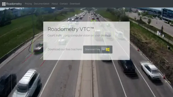 Roadometry Count traffic using computer vision on your desktop.
Roadometry provides desktop software utilizing computer vision to count traffic, offering valuable data for transportation analysis and system integration.
- Free Trial
-
 TransLoc Transportation solutions at the speed of life
TransLoc provides comprehensive transit software solutions for fixed route and on-demand transportation systems, helping agencies optimize operations and enhance rider experiences.
- Contact for Pricing
-
 Wings Engine Interactive 3D and XR Creation Platform for the Web
Wings Engine is a no-code, web-based platform designed to enable interactive 3D and XR creation with real-time rendering, suitable for industries ranging from product display to building planning.
- Other
-
 Humans.ai Making AI Work for Humans
Humans.ai is an AI and blockchain ecosystem offering personalized AI tools designed to deliver transparent, equitable, and ethical AI solutions. It pioneers a decentralized approach to data validation, ensuring fair and unbiased AI systems.
- Contact for Pricing
-
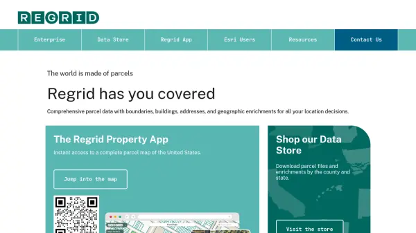 Regrid Comprehensive parcel data with boundaries, buildings, addresses, and geographic enrichments for all your location decisions.
Regrid provides comprehensive parcel data for the U.S. and Canada, including boundaries, ownership, addresses, and geographic insights, accessible via app, data store, API, and enterprise solutions.
- Freemium
-
 Hayden AI Revolutionizing Problem-Solving with AI
Hayden AI provides an AI-powered mobile perception platform that utilizes deep learning for various applications, including automated traffic enforcement and data-driven insights for cities.
- Contact for Pricing
-
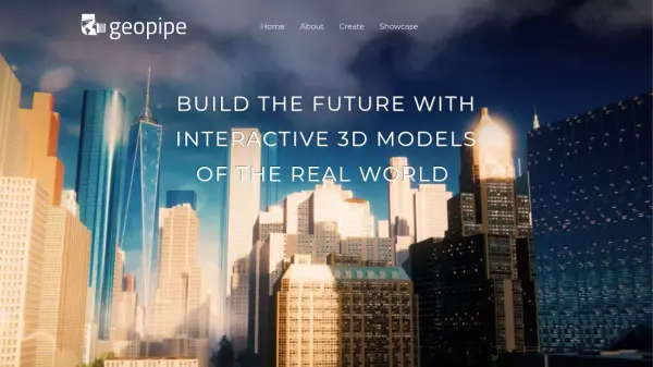 Geopipe Build the Future with Interactive 3D Models of the Real World
Geopipe uses AI to create interactive 3D models of real-world environments from sensor data. Stream vast digital twins directly into Unity, Unreal Engine, or download as 3D meshes for simulations, gaming, and VR experiences.
- Contact for Pricing
-
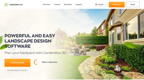 GardenBox 3D User-Friendly 3D Landscape Design Software for Homeowners
GardenBox 3D is powerful, user-friendly landscape design software that allows users to create and visualize garden, backyard, and exterior house plans in 3D, complete with customizable materials and real-time previews.
- Freemium
-
 CYLIND Top-tier Architectural Visualization Services for Architects and Real Estate Developers
CYLIND is a full-scope 3D architectural visualization studio that creates photorealistic renderings, animations, virtual tours, and floor plans to help architects and developers communicate designs effectively with stakeholders.
- Contact for Pricing
-
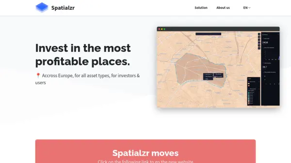 Spatialzr Invest in the most profitable places.
Spatialzr offers real-time market analysis and site selection algorithms for commercial real estate (CRE) across Europe, aiding investors and businesses in making informed location decisions.
- Paid
- From 216$
-
 Runopt AI-powered software for land development delivering cost-effective, sustainable designs in minutes.
Runopt is an AI-powered software transforming land development by integrating design optimization for cost-effective, sustainable designs. It streamlines site analysis, grading, drainage, and reporting for civil engineers and developers.
- Contact for Pricing
-
 Dassault Systèmes Virtual Worlds for Real Life
Dassault Systèmes provides businesses and people with virtual universes to create sustainable products and services. Leveraging virtual twin experiences, the company drives innovation across various sectors.
- Contact for Pricing
-
 PlantMaster Streamline Landscape Plant Presentations and Reports
PlantMaster delivers robust plant database management and interactive presentation tools for landscape professionals, enabling effortless plant selection, customization, and project reporting.
- Free Trial
-
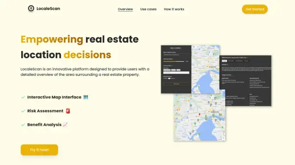 LocaleScan Empowering Real Estate Location Decisions
LocaleScan provides a detailed overview of areas surrounding real estate properties, utilizing AI to assess risks and benefits for informed decision-making.
- Free
-
 EOfactory Actionable geo-intelligence to ensure sustainability
EOfactory provides actionable geo-intelligence solutions using AI and ML for various industries, focusing on sustainability and science-based decisions. Access satellite imagery, process data, and visualize insights through custom dashboards.
- Free Trial
-
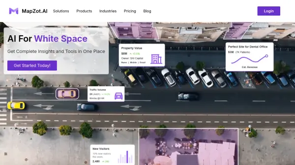 MapZot.AI AI-Powered Location Analytics for Strategic Expansion
MapZot.AI provides AI-driven location analytics to help businesses optimize site selection, market planning, and sales forecasting. Leverage real-time data and insights for strategic growth and expansion.
- Contact for Pricing
-
 Permitify Design with Confidence. Submit with Certainty.
Permitify offers AI-powered site-specific code research and plan review for architects and engineers, helping to catch compliance issues early and streamline the permit submission process.
- Paid
- From 99$
-
 xyzt.ai Turn your IoT data into actionable insights
xyzt.ai is a powerful platform that combines spatial and time series analysis to visualize and analyze spatio-temporal data from any source, regardless of size. It specializes in IoT, maritime, and mobility data analytics with GenAI-powered insights.
- Contact for Pricing
-
 FlyPix AI Geospatial AI Platform for Analyzing Earth's Surface
FlyPix AI is a geospatial analysis platform that uses AI to detect and analyze objects in images. Train custom AI models and analyze geospatial data tied to coordinates.
- Freemium
- From 50$
-
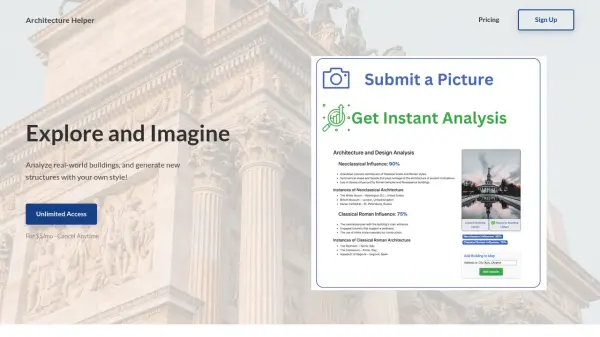 Architecture Helper Explore and Imagine Architecture Through AI Analysis and Generation
Architecture Helper is an AI-powered platform that analyzes real-world buildings and generates new architectural designs. For $5/month, users can analyze buildings, generate custom designs, and explore different architectural styles.
- Paid
- From 5$
-
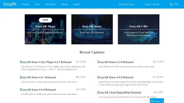 EasyAR Spatial Computing Platform Connecting Everything
EasyAR offers a spatial computing platform with solutions for city-scale mapping, localization, and AR experiences, catering to various industries.
- Freemium
- From 49$
-
 Every Door The best OpenStreetMap editor for POIs and entrances.
Every Door is an open-source OpenStreetMap editor designed for mapping points of interest, entrances, and micro-mapping features with offline capabilities and AI-assisted data validation.
- Free
-
 Pataa The New Language of Address!
Pataa is an advanced addressing solution that provides short, unique digital address codes to simplify long and complex addresses, enhancing delivery efficiency and customer experience.
- Free Trial
-
 GoodVision AI-Driven Traffic Solutions for Safer, Smarter Cities
GoodVision offers AI-powered traffic monitoring and analytics solutions that help cities optimize traffic flow, prevent congestion, and enhance road safety through real-time camera-based analytics.
- Contact for Pricing
-
 Spectator Live Satellite Monitoring and Centralized Data Access
Spectator is an AI-powered platform that provides seamless access to Earth observation satellite data from programs like Copernicus Sentinels and USGS/NASA Landsat, offering daily fresh satellite images, high-resolution commercial imagery, and flexible tools for tracking satellite passes and scheduling imaging.
- Freemium
-
 Wayfindr Empowering Independent Indoor Navigation for the Vision Impaired
Wayfindr is an award-winning non-profit creating accessible audio navigation standards to help blind and partially sighted individuals navigate indoor environments independently.
- Free
-
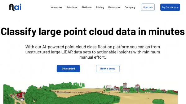 Flai AI-powered point cloud classification platform for LiDAR data processing
Flai is an advanced platform that transforms unstructured LiDAR datasets into actionable insights through AI-powered point cloud classification, offering both cloud-based and self-hosted solutions for efficient data processing.
- Freemium
- From 20$
-
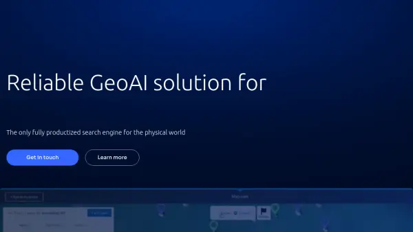 Picterra Reliable GeoAI solution for sustainability, compliance, transparency, accountability, monitoring, and verification.
Picterra is a GeoAI platform that enables users to build and deploy custom AI models for geospatial imagery analysis. It supports various data types and offers solutions for multiple industries, facilitating scalable and collaborative geospatial analysis.
- Contact for Pricing
-
 Seety Drive. Park. Relax. Save time and money on your parking, gas fill-ups, and electric recharges.
Seety is a comprehensive mobility app that helps drivers find, pay for, and manage parking, fuel, and electric vehicle charging across Europe with real-time information and transparent pricing.
- Free
-
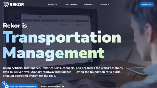 Rekor Revolutionary Roadway Intelligence Powered by AI
Rekor is an advanced AI-powered roadway intelligence platform that collects, connects, and analyzes mobility data to provide comprehensive traffic management, vehicle recognition, and public safety solutions.
- Contact for Pricing
-
 OutlineAI Revolutionizing real estate feasibility studies and schematic designs with AI.
OutlineAI utilizes artificial intelligence to automate and optimize architectural design processes, significantly reducing time and improving efficiency for real estate projects.
- Contact for Pricing
-
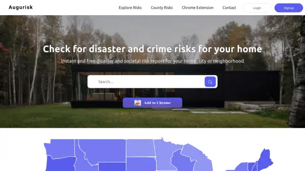 Augurisk Instant Disaster and Societal Risk Assessment
Augurisk provides instant and free disaster and societal risk reports for homes, cities, or neighborhoods in the United States.
- Freemium
- From 90$
-
 AIBOT The High-Tech & High Performance aiEVTOL
AIBOT is developing AI-defined, high-performance electric Vertical Take-Off and Landing (aiEVTOL) aircraft to revolutionize regional mobility, offering a safe, zero-emission, and cost-efficient solution.
- Contact for Pricing
-
 Blackshark.ai Real-time Semantic 3D Digital Twin of the Planet
Blackshark.ai generates a real-time, accurate, semantic, and photorealistic 3D digital twin of the entire planet using machine learning and satellite imagery. This technology supports various applications, including simulation, visualization, and geospatial analytics.
- Contact for Pricing
-
 Carta Maps Build Custom Interactive Maps with Ease
Carta Maps is an AI-powered platform for creating custom interactive maps with intuitive styling tools, real-time collaboration, and advanced features like geocoding, boundary finding, and drawing tools.
- Freemium
- From 9$
-
 Terminus Group Shaping the Next Generation of Technology with AIoT
Terminus Group is an international AI smart service provider, specializing in Artificial Intelligence & Internet of Things (AIoT) solutions for smart cities, sustainable development, and robotics.
- Contact for Pricing
-
 Roadcount Monitor and record traffic on your street, 24/7, automatically on your phone
Roadcount utilizes your phone to automatically monitor, count, and record street traffic 24/7, providing evidenced data including speed estimates.
- Contact for Pricing
-
 LandGlide Comprehensive Parcel Data and Property Line Mapping Anywhere
LandGlide offers advanced parcel data and property line mapping with GPS location, providing access to over 157 million U.S. parcel records on desktop and mobile devices.
- Freemium
- From 10$
-
 Pelias Geocoder A modular, open-source search engine for our world
Pelias is an open-source geocoder that transforms addresses and place names into geographic coordinates and vice versa, powered by open data and built on Elasticsearch for fast global search.
- Freemium
-
 Danti Make sense of the world's data through intelligent search and analysis
Danti is an AI-powered search and analysis platform that synthesizes diverse data sources including imagery, news, and social media to provide comprehensive insights about any location on Earth.
- Contact for Pricing
-
 NextGIS All-in-one GIS platform for maps and geodata
NextGIS provides comprehensive GIS solutions with web, mobile, desktop, and server tools for creating, managing, and sharing spatial data and interactive maps.
- Contact for Pricing
-
 Garudalytics Solving real-world challenges using GeoAI.
Garudalytics provides Geospatial AI (GeoAI) solutions, extracting insights from location data to address challenges across various sectors.
- Contact for Pricing
-
 FixMyStreet Mapping and reporting street problems to the councils responsible for fixing them – anywhere in the UK.
FixMyStreet is a UK-based platform that enables citizens to report local street problems like potholes, graffiti, and fly-tipping directly to their local councils, with over 34,000 reports weekly and 42,000 issues fixed monthly.
- Free
-
 Takeout Tools Export Real Location Data from Your Google Maps Saved Places
Takeout Tools transforms Google Takeout exports by automatically extracting addresses and coordinates from Google Maps URLs, converting them into usable formats like CSV, JSON, GPX, KML, and GeoJSON for mapping tools, GIS applications, and spreadsheets.
- Freemium
- From 190$
-
 Visoid Quick and easy rendering software for architects, powered by AI
Visoid is an AI-powered 3D rendering software that enables architects to create high-quality visualizations in seconds, with support for any 3D design application and simple three-step workflow.
- Freemium
- From 29$
-
 GeoAI Harnessing AI and Spatial Data for Innovation
GeoAI combines Artificial Intelligence with geospatial engineering to analyze location-based data, satellite imagery, and advanced analytics for smarter decision-making in various industries.
- Contact for Pricing
-
 PAM Transform Complex Spaces into Seamless Destinations
PAM is a cloud-based digital wayfinding platform that integrates navigation, customer experience, and operational management for large, complex environments such as stadiums, airports, campuses, and smart cities.
- Contact for Pricing
-
 Bee Maps Simplify Fleet Management with AI-Powered Mapping Insights
Bee Maps offers AI-powered fleet management solutions and hyper-fresh mapping data APIs for optimized routing, cost savings, and real-time monitoring.
- Contact for Pricing
Featured Tools
Join Our Newsletter
Stay updated with the latest AI tools, news, and offers by subscribing to our weekly newsletter.
Explore More Professions
Didn't find tool you were looking for?