 ReddRadar
Top AI tools for Hiker
-
 GPSLog Labs Analyze, map, graph, compare, and report on your GPS activity logs
GPSLog Labs is an AI-powered platform for analyzing, mapping, and tracking GPS activity logs from various devices, offering detailed insights and performance metrics for exercise, training, and lifelogging.
- Free
-
 Footpath Plan your next adventure in seconds
Footpath is an AI-powered route planning app that enables users to create custom routes with distance measurement, elevation analysis, and turn-by-turn navigation using offline topographic maps.
- Freemium
- From 5$
-
 Audio Tour App Real-time location-based audio tours for independent explorers worldwide.
Audio Tour App is an AI-powered audio tour application that adapts to your location in real-time, providing personalized narration about your surroundings as you walk, with privacy-first data handling.
- Free
-
 Travelfoss Unique Travel Stories and Complete Travel Guides for Planning Your Next Trip Anywhere in the World
Travelfoss provides comprehensive travel guides, detailed itineraries, and inspiring travel stories to help adventurers plan unforgettable trips worldwide.
- Free
-
 Ferrata Guide Your via ferrata companion for finding, climbing, and rating via ferratas worldwide.
Ferrata Guide is a comprehensive platform and mobile app that helps climbers discover, plan, and track via ferrata routes globally, with features like maps, difficulty ratings, and community-driven content.
- Freemium
- From 2$
-
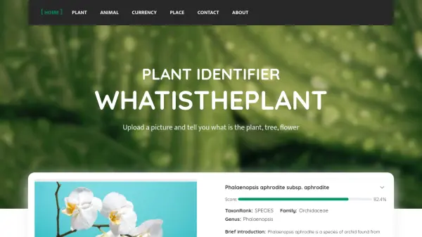 WhatisthePlant Upload a picture and identify plants, trees, and flowers.
WhatisthePlant is a free, AI-powered tool for identifying plants, trees, and flowers from uploaded images, providing fast and accurate results.
- Free
-
 adidas Running (Runtastic) Track Workouts, Personalize Training, and Join a Global Community
adidas Running (formerly Runtastic) helps users track physical activities, achieve fitness goals, and personalize training with adaptive plans and motivation features.
- Freemium
-
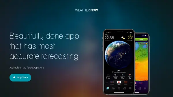 WEATHER NOW Accurate Global Weather Forecasts with Stunning 3D Visuals
WEATHER NOW is a weather app offering precise forecasts and immersive 3D imagery, available globally with real-time data updates.
- Paid
-
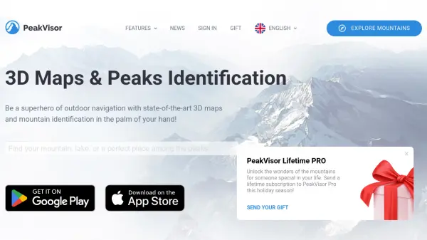 PeakVisor 3D Maps & Real-Time Peak Identification for Mountain Explorers
PeakVisor is an advanced outdoor navigation app offering 3D maps, real-time mountain identification, and offline capabilities, designed for hikers, climbers, and outdoor enthusiasts worldwide.
- Freemium
-
 My Elevation Accurate elevation and location data for Android users worldwide
My Elevation is an Android application that provides precise surface elevation data using web-based sources, helping users explore terrain with features like Follow Me mode, search functionality, and customizable map options.
- Free
-
 Grid Share Your Location, Not Your Privacy
Grid is an end-to-end encrypted location sharing app that protects user privacy with secure technology, allowing users to share locations with family, friends, and co-workers without compromising data security.
- Freemium
- From 5$
Featured Tools
Join Our Newsletter
Stay updated with the latest AI tools, news, and offers by subscribing to our weekly newsletter.
Explore More Professions
Didn't find tool you were looking for?